State Borders
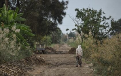
Located in north-eastern Africa, the Republic of Sudan has a total area of 1.9 million square kilometers. It is bordered by Egypt to the north, Libya to the north-west, Chad to the west, the Central African Republic to the south-west, South Sudan to the south, Ethiopia to the south-east, and the Red Sea to the east. The population in July 2015 was an estimated 36.1 million people.
Rivers
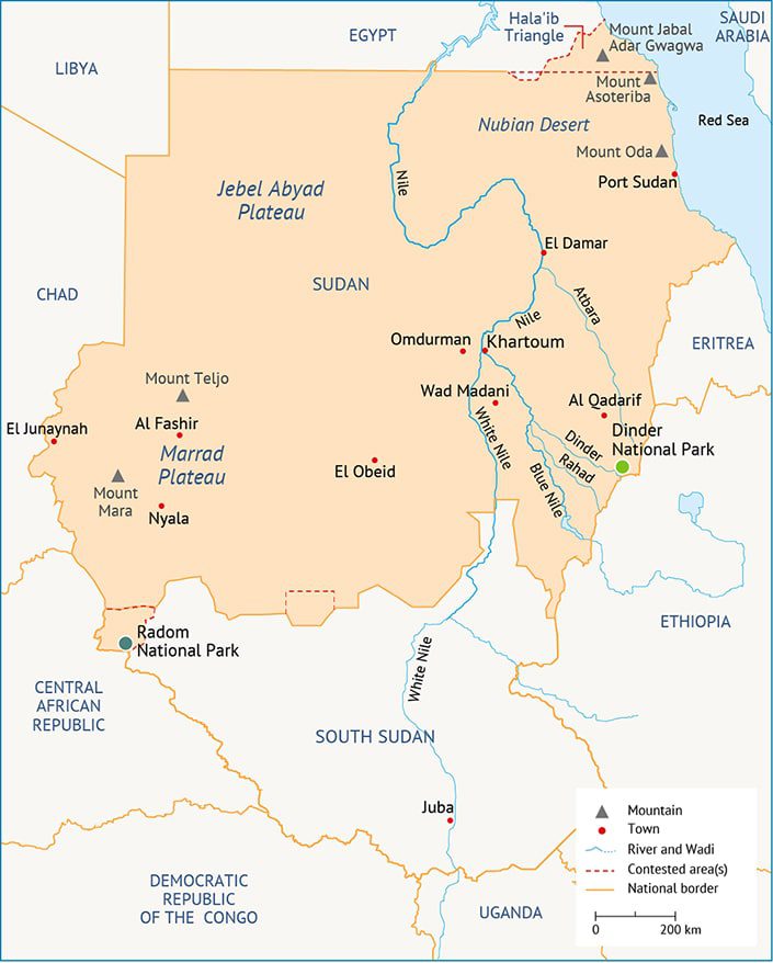
The Nile is Sudan’s most prominent topographical feature and the country’s primary source of water. It has two major tributaries: the White Nile, which originates in the Great Lakes region of central Africa, and the Blue Nile, which begins in the Ethiopian Highlands. The two tributaries meet at the capital Khartoum, from where the river is called the Nile as it continues northwards into Egypt.
The White Nile gets its name from whitish clay that is suspended in its waters. When the Nile floods, deposits of silt act as a rich fertilizer for the soil.
Other important tributaries of the Nile are the Atbara, Dinder, and Rahad. There is also a group of large seasonal wadis, including Wadi al-Malik, Wadi Hawr, Wadi al-Magadam, and Wadi Azoum in the west, and Wadi Khor Baraka and Wadi al-Gash in the east. Several other wadis flow from the Red Sea Hills westwards into the interior and, conversely, from the west towards the sea.
Mountains
The vast plains in central Sudan are bordered on three sides by mountains: the Red Sea Hills to the north, the Marrah Mountains to the west, and the Didinga Hills to the east. The Red Sea Hills represents the western edge of the Great African Rift Valley, which stretches from East Africa across the Red Sea to the Jordan River Valley and the Sea of Galilee in Israel. The volcanic highlands of the Marrah Mountains rise out of the Darfur Plateau to elevations of
between 900 and 3,000 meters above sea level. In south-central Sudan, rugged granite hills rise sharply from a wide clay plain, the largest group of which forms the Nuba Mountains.
Geology
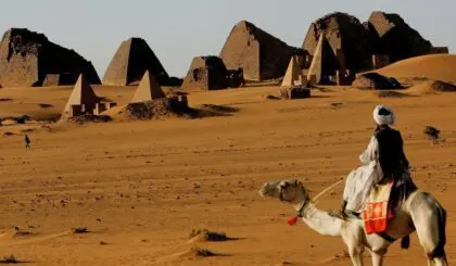
Sudan’s landscape is characterized by isolated mountains and hills that rise up suddenly from deserts and clay plains. These are mostly the remnants of igneous or sedimentary rocks from different geological eras that withstood erosion.
Sedimentary rocks are found in large parts of the country. Nubian sedimentary rocks cover large parts of the northern, eastern, and western regions. Volcanic rock formations are scattered across the north and along the eastern border with Ethiopia. Modern sediments of mudstone, sandstone, clay, and iron also cover large areas.
The oldest geological formations belong to the Precambrian period, represented by basement rocks, and cover most of the eastern, western, central, and southern regions. Dating from the first and second geological eras, especially the Cretaceous period, are the Nubian sandstones that cover vast areas of the northern and central regions. In the central region is the Um-Rawaba, a formation rich in groundwater that dates from the third geological era. Rock formations settled throughout the fourth geological era up to the present day.
Climate and Climatic Regions
Sudan has a tropical climate, characterized by generally high temperatures with significant seasonal and regional differences. Temperatures in the dry northern region can exceed 45 degrees Celsius and rainfall is negligible. High temperatures also occur throughout the semi-arid central plains region and humidity is generally low. The semi-wet region covers the southern parts of the country, along the border with South Sudan. The Red Sea coast has a different climate from the rest of the country, associated with the formation of Lake Nubia behind the Aswan High Dam due to the humidifying effect of the lake waters.
Vegetation
Sudan’s vegetation is closely related to the climatic zones. From the desert in the north, the vegetation gradually improves through semi-arid shrubs to low woodland savannah characterized by acacia trees and short grasses. On the uplands of the southern border, rainfall is sufficient to support tropical rainforests.
Soil
The country’s soils can be divided into three categories: The soil of the dry desert zones is loose sand or a mixture of sand and gravel or rocks. A deep clay soil (black cotton soil) of river origin extends from the east westwards across most of the central region, in particular the Gezira area. Similar clay soil can be found around the Nuba Mountains. In the west, sandy soil is dominant except in the Marrah Mountain area, which is covered in rich volcanic soil.
Natural Resources
Sudan’s major natural resource is petroleum, but it also has small reserves of iron ore, copper, chromium ore, zinc, tungsten, mica, silver, gold, and hydropower.
Agricultural Land
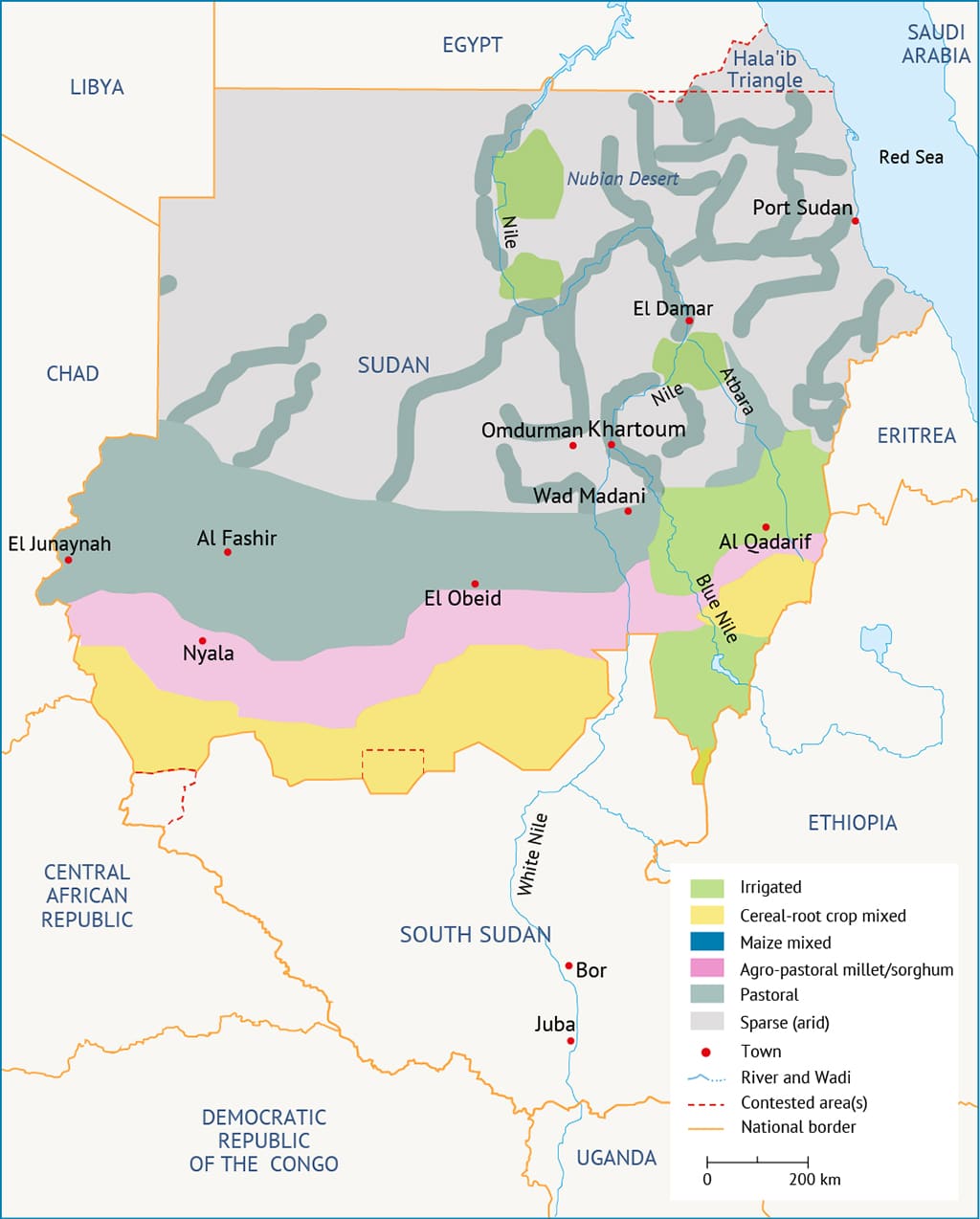
Approximately one-third of Sudan’s total area is suitable for agriculture. According to an official 2015 estimate, total arable land is 31.5 million hectares (75 million feddans), of which 25% is actually cultivated.
According to the annual report of Sudan’s Central Bank, irrigated agriculture in 2014 amounted to 3.3 million feddans whereas rain-fed agriculture was 36 million feddans.
Water Resources
Sudan has enormous water resources, including 1,000 billion cubic meters (BCM) of annual rainfall and 1,085BCM of Nile water, in accordance with the 1959 water-sharing agreement signed with Egypt. However, water is scarce during the dry season in areas that are not located on the river. The amount of renewable groundwater is estimated to be around 4.02BCM.
Nature Reserves
Sudan’s main nature reserves are Dindir, al-Rdom, Wadi Hawr, Diyar Mountain, Hassani Mountains, Dnguenab, Snguenib, Raya Basendh, and Galabat. Dinder is considered to be the most important reserve. Covering an area of approximately 10,000 square kilometers, it is a model for a global wildlife park and a popular destination for tourists from around the world. The park is home to 27 species of large mammals, including African leopards, Masai lions, and cheetahs, over 160 species of birds as well as 32 species of fish, small mammals, bats, reptiles, amphibians, and ostriches.
Environmental Issues
Two-thirds of northern Sudan is affected by desertification, largely as a result of decreasing rainfall, soil erosion, and deforestation. In addition to natural factors, human activity is exacerbating the problem, especially overgrazing, agricultural expansion, and logging. Land affected by desertification is confined to areas between latitudes 10-18 degrees north, comprising a total area of 126,000 square kilometers or roughly 51% of the country’s total area.
Other environmental issues include deteriorating water resources, periodic droughts, pollution caused by herbicide and pesticide use, loss of biodiversity, and declining wildlife populations due to excessive hunting.
Solar Energy
Sudan has high solar radiation, estimated at 5.4kWh/m²/day according to the readings of the Meteorological Authority. The average brightness period is no less than ten hours per day. The total solar energy read in some Sudan cities amounts to an average of 2.8 gigajoules/m²/year, which could be used in the electrification of rural areas.
Projects launched by the General Directorate of Energy Affairs, the Energy Research Institute, and the Community Development Fund have been able to install around two megawatts (MW) of solar energy in remote rural areas. The government aims to increase that amount to around 20,000MW within the next 20 years.
Latest Articles
Below are the latest articles by acclaimed journalists and academics concerning the topic ‘Geography’ and ‘Sudan’. These articles are posted in this country file or elsewhere on our website: