State Borders
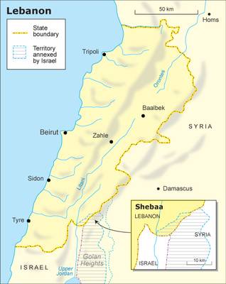
Lebanon is located on the eastern shore of the Mediterranean Sea. It borders the Sea in the west, Syria in the north and east, and Israel in the south. Its surface is officially 10,400 square kilometres, but small parts of the borders with Syria and Israel are contested. Lebanon is one of the smallest countries in the region, smaller even than Qatar. Compared to its immediate neighbours, Lebanon is about half the size of Israel, and almost 18 times smaller than Syria.
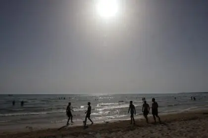
The coastline is 225 kilometres long, Lebanon’s land boundaries total 454 kilometres, of which 375 kilometres with Syria and 79 kilometres with Israel.
 Administratively, Lebanon is divided into eight governorates (muhafazat): Beirut (1), Mount Lebanon (2), North Lebanon (3), South Lebanon (4), Nabatieh (5), the Beqaa (6), Baalbek-Hermel (7) and Akkar. Each governorate is headed by a muhafiz (governor), and is divided into districts, qadas (cazas or aqdiya).
Shebaa Farms and the Golan Heights

Lebanon’s land borders are not entirely clear. On most official maps, small parts of its south-eastern border in Mount Hermon, Shebaa Farms (25 square kilometres), and the adjacent Nkhaileh (13 square kilometres, main town Ghajar), are marked as Syrian. According to the cadastres, however, these are Lebanese.
This was apparently done by mistake by French cartographers in the 1920s, and although it was known to the authorities, it was never amended.
In 1967, these territories were occupied by Israel as part of the Syrian Golan Heights. In 2000, when Israel withdrew from South Lebanon, its army stayed in the Shebaa Farms, prompting military actions from Hezbollah in return. Ghajar’s situation is even more complicated, because the southern half is in Lebanon, whereas the northern half is occupied by Israel as part of the (Syrian) Golan Heights.
In February 2010, United Nations Secretary General Ban Ki-moon expressed his ‘concern over Israel’s continued occupation of the northern part of the village of Ghajar, north of the Blue Line, and ‘call[ed] on the Government of Israel, in accordance with its obligations under resolution 1701 (2006), to complete its withdrawal from the area without further delay’.
Geography and Climate
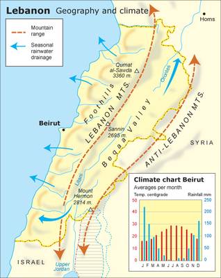
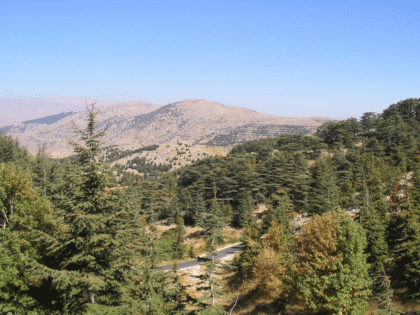
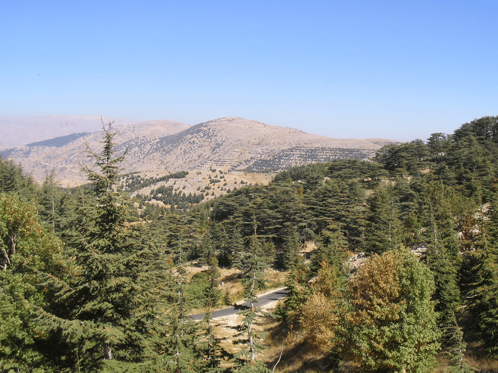
Lebanon consists of a sometimes extremely narrow coastal plain bordering an imposing mountain range, the Lebanon Mountains (Jabal Lubnan or al-Jibal al-Gharbiya, 240 kilometres long, stretching across nearly the whole length of the country) and, more to the east, the Anti-Lebanon Mountains. The highest peak is Qurnat al-Sawda (3,088 metres) in the northern part of the Lebanon Mountains. The renowned cedars of Lebanon grow on the west flank of this peak.
The Lebanon range is separated from the Anti-Lebanon Mountains (Jibal Lubnan al-Sharqiya) by the fertile Beqaa Valley, approximately 180 kilometres long and 10 to 26 kilometres wide. Through this valley flows the Litani, Lebanon’s main river, which reaches the Mediterranean Sea near the city of Tyre (Sur) in the south-west.
In the south-east, the Beqaa Valley becomes hilly and blends into the foothills of Mount Hermon (Jabal al-Shaykh, 2,814 metres), the highest part of the Anti-Lebanon range.
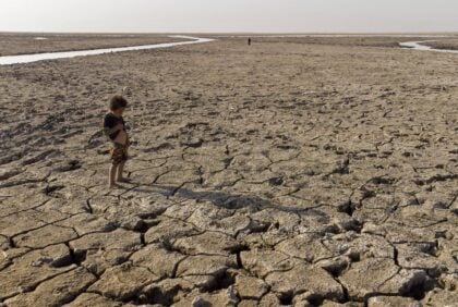
The climate is Mediterranean, with mild to cool, wet winters and hot, dry summers. However, there are large regional, even local, differences. The average temperatures range from 32 ºC in July to 16 ºC (coast) or 10 ºC (Beqaa Valley) in January.
The higher mountain ranges are colder and can experience heavy winter snowfall. There, the snow sometimes remains till early summer. In the coastal regions and lower parts of the mountains, winters tend to be rainy.
Geologically, Lebanon consists almost exclusively of limestone, generally of Cretaceous origin, with Jurassic limestone in some areas, mainly in the south. Basaltic rocks are found in a few places, especially in the north in Akkar.
Biodiversity and Natural Environment
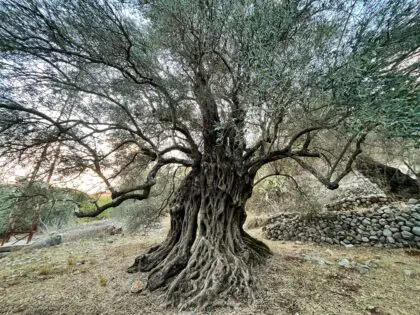
In ancient and medieval times, Lebanon was covered with forests. However, most of the timber – including Lebanon’s famous cedar wood – has been chopped down and used for (ship) building or exported. Overgrazing has been another factor in the ensuing deforestation, as well as forest fires, the exploitation of quarries, agricultural land expansion, soil erosion and desertification, climate change, urban expansion and migration, (armed) conflicts and a general lack of public awareness. Cedar forests are now restricted to the steeper and less accessible high altitude areas. At present, forests and woodlands cover approximately 13.3 percent of the overall area in Lebanon.
However, since the 1960s, extensive reforestation activities have been undertaken, in particular on the upper western slopes of Mount Lebanon (the Chouf Cedar Nature Reserve). A National Reforestation Plan (NRP) aims at reforesting 20 percent of the country’s territory, according to the Ministry of Environment.
Despite the deforestation, Lebanon’s biodiversity is rich. This ecological diversity results from the Mediterranean climate, but also from Lebanon’s vast array of geomorphologic regions, from mountain ranges to fertile plains and coastal zones, which has led to the development of distinct microclimates, resulting in the emergence of various habitats attracting a wide range of species: 4,633 plant species (2,863 native plants, among which the Lebanon Cedar) and 4,486 animal species, among which the rare loggerhead turtle and the imperial eagle.
Natural Resources
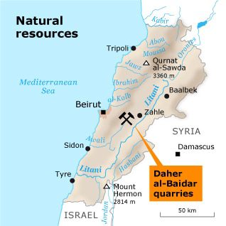
Timber used to be an important resource, but extensive exploitation of the ancient (cedar and oak) forests, as well as the traditional herding of goats and sheep have led to deforestation.
Lebanon’s mineral resources are few: iron ore, lignite, lime, and high-quality sand, which is suitable for glass manufacture.
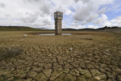
There are also building-stone quarries. The Litani River provides electricity (Litani River hydroelectric project).
Land Fertility
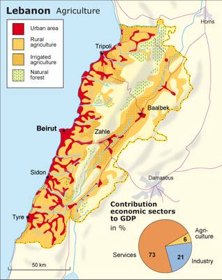
Two-thirds of Lebanon’s total surface consists of agricultural land, half of which is to be found in the Beqaa Valley, irrigated by the 145 kilometre long Litani River. The other half of the agricultural land is located mainly on the coast and in the northern mountains, where reddish topsoil with high clay content provides fertile land for agriculture.
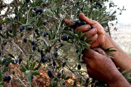
The higher parts of the mountains are covered by a thin layer of limestone soil, which is relatively poor. The lower and middle slopes are intensively cultivated (terraced hills). Lebanon produces a large quantity of vegetables and fruits, such as citrus, grapes, tomatoes, apples, vegetables, potatoes, olives, and tobacco; it also herds sheep and goats. The agricultural sector accounts for 6 percent of GDP.
20 percent of the agricultural land is irrigated, and 42 percent of the cultivated land is irrigated at least once a year (statistics of 1999; more recent data are not available), representing some 104,000 hectare. This surface is expected to be extended to 150,000 hectare before 2018, if all the irrigation projects are realized.
Nature Reserves
Lebanon has a large number of protected areas, among which eight nature reserves. The most important of these are the Chouf Cedar Nature Reserve (1), Tannourine Cedars Forest Nature Reserve (2), Horsh Ehden Nature Reserve (3), Palm Islands Nature Reserve (4), and the Tyre Coast Nature Reserve (5).
al-Chouf Cedar Nature Reserve
By far the largest is the Chouf Cedar Nature Reserve, which covers an area of 165 square kilometres. It extends along the western ridge of Mount Lebanon at an altitude of 1,000 to 2,000 metres, overlooking the Beqaa Valley. Al-Chouf consists of three cedar forests (Maasir al-Chouf, Barouk and Ayn Zhalta/Bmohray), parts of which were planted in the 1960s in a massive attempt at reforestation. This nature reserve, located on the intercontinental migratory route for birds, is considered a suitable location for the conservation of large mammals such as the wolf and the caracal lynx.
Tannourine Cedars Nature Reserve
Also important is the high-altitude Tannourine Cedars Nature Reserve, one of the densest, oldest and largest cedar forests in Lebanon (80 percent of the trees are cedars). It is located in the mountains east of Byblos, south-east of Tripoli, covering 12 square kilometres. In this rocky and mountainous area, cedars grow on extremely steep slopes. Some of the 70,000 ancient cedar trees are more than a thousand years old. Tannourine is also known for its various types of birds (eagles, owls, robins) and wild animals (hyenas, boars, squirrels, snakes, and bats).
Horsh Ehden Forest
Also located in the Lebanon Mountains, Horsh Ehden Forest is a unique assemblage of conifers, deciduous and evergreen trees in an isolated phyto-climatic region. The forest is home to different species of mammals, birds, and plants of which some are rare and threatened in Lebanon, such as the imperial eagle and the wolf. Indicators of the biodiversity of the protected area include 1,030 plant species, 39 tree species, 26 mammal species, 156 bird species, and 300 fungi species.
Palm Islands Nature Reserve
Palm Islands Nature Reserve is located to the north-west of Tripoli. It has been designated a Mediterranean Specially Protected Area under the Barcelona Convention, an Important Bird Area by the Birdlife Convention as well as a Wetland of Special International Importance.
Tyre Coast Nature Reserve
Tyre Coast Nature Reserve is on the Ramsar list of internationally important wetlands. Located in southern Lebanon, extending over 380 hectare, it is a nesting site for, among others, the endangered loggerhead turtle and the green sea turtle.
Latest Articles
Below are the latest articles by acclaimed journalists and academics concerning the topic ‘Geography’ and ‘Lebanon’. These articles are posted in this country file or elsewhere on our website: